In-Person Event
located at
Terry Badlands Wilderness Study Area, Calypso Trail, Natural Bridges Trail
Latitude: 46.8133
Longitude: -105.5452
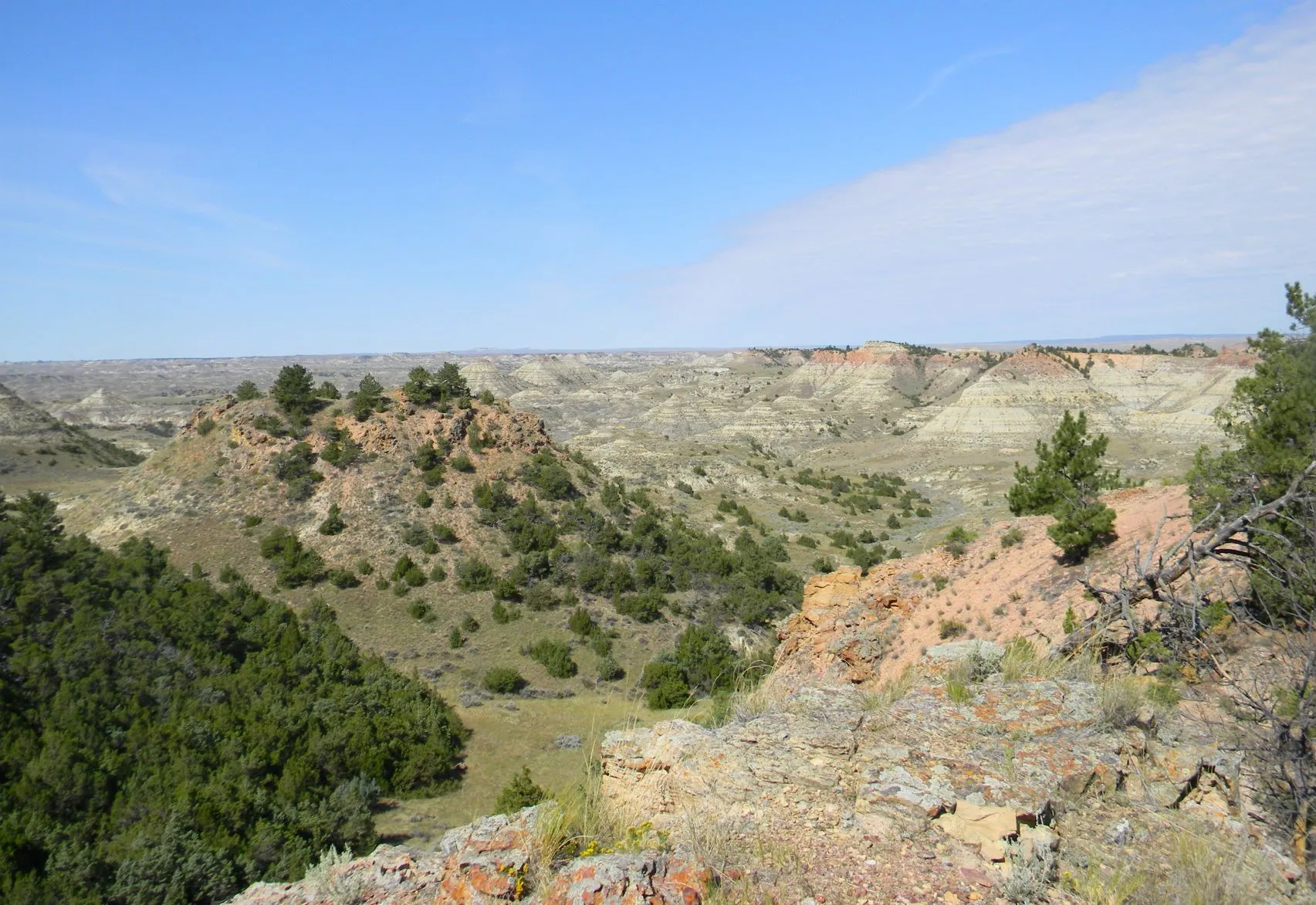
The Terry Badlands Wilderness Study Area (WSA) is located 3 miles northwest of Terry, Montana in Prairie County. The WSA consists of 42,950 acres of public land and is separated by a road, the Calypso Trail.
The WSA contains deep parallel drainages emptying southeast into the Yellowstone River. Banded, colorful cliffs overlook the rolling prairie vegetated with range grasses, native legumes and scattered juniper. One of the nation's most easterly stands of limber pine is found in the northwestern portion of the WSA.
The bottom lands on the north bank of the Yellowstone River are surrounded by steep, eroded slopes, divided by many deep gullies. The rough hillsides, studded with sandstone bridges, buttes, tabletops, spires, and small scoria escarpments, rise to meet rolling benches north of the river. Elevations range from 2,900 feet in the north to 2,180 feet in the southeastern corner along the Yellowstone River.
Scenery is outstanding, geologic features include the sandstone bridges, tabletops, springs, and buttes formed by thousands of years of wind and water erosion. (Montana Statewide Wilderness Study Report, September 1991, BLM, EIS)
This extremely rugged, but absolutely breathtaking landscape is a great candidate for a volunteer service day. The Natural Bridges Trail, namely, leads to some amazing sandstone bridges within the WSA. Due to some washouts, the original trail route leads folks to some steep downhill grades and, overall, makes the trail more arduous than need be. The plan is to re-establish the trail and add trail markers accordingly. It should be simple, but as we all know, 'many hands make light work'. We will have tools and supplies available and plenty of water. Please be prepared with work gloves, a water bottle or hydration pack, and snacks. This is rough terrain we will be working in so please dress accordingly with long pants and boots, and prepare for the elements by wearing layers, sunscreen, bug spray, a hat and sunglasses. Lunch will be provided.
2025 marks the 25th Anniversary of the National Conservation Lands (NCLS)! These ruggedly beautiful wonders, located primarily in the West, feature some of the nation’s most spectacular landscapes including national monuments, national conservation areas, wilderness areas, wilderness study areas, wild and scenic rivers, and national scenic and historic trails. The Terry Badlands WSA has been designated by Congress as part of the National Conservation Lands system. All the more reason to join in the fun! Help us celebrate these two events on September 20th!
How to get there?!?
From Terry, MT, take Old Highway 10 west of Terry for two miles, turn right onto the Milwaukee road. You will need to cross the Historic Milwaukee Railroad Bridge which is one-way traffic only. After crossing the bridge, the Calypso Trail (which is a road) begins on your right hand side. Follow the Calypso Trail past the interpretive sign to the left– if you continue right you will go to the Calypso Special Recreation Management Area next to the Yellowstone River. If you prefer, there will be someone at the Calypso Interpretive sign to lead folks to the work site. They will leave that location at 9am. Please plan accordingly.